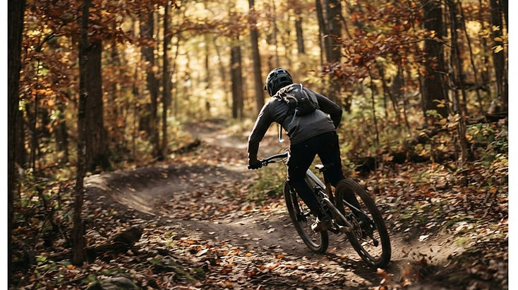
Location: Chelsea · Distance: 22 miles across four interconnected loops · Difficulty: Beginner to advanced
If you're looking for one of Southeast Michigan's most exciting mountain biking experiences, the DTE Energy Foundation Trail should be near the top of your list.
Located in Waterloo Recreation Area near Chelsea, this purpose-built singletrack system is designed around flow: sweeping turns, rolling terrain, smooth transitions and opportunities to maintain momentum. The Michigan DNR calls the mechanically cut surface a "flow trail," and riders have nicknamed it Michigan's dirt rollercoaster.
The system is a collection of four interconnected loops, so riders can choose a route matched to their experience and add mileage as their skills grow. The trail also welcomes runners, hikers and cross-country skiers, and foot traffic travels the opposite direction of bikes.
| Loop | Length | Riding experience |
|---|
| Green Lake | 5.2 miles | Gentle, beginner-friendly opening loop |
| Big Kame | 4.8 miles | More of a workout, intermediate progression |
| Winn | 8 miles | Longer and technical |
| Sugar | 4 miles | The system's most challenging section |
Loop lengths come from the Michigan DNR's DTE Energy Foundation Trail page and should still be checked against the current trail map before you plan a ride.
Riding direction: bikes ride clockwise on Monday, Wednesday, Friday and Sunday, and counter-clockwise on Tuesday, Thursday and Saturday. Foot traffic travels the opposite direction.
Trailhead note: the DNR lists three separate parking areas — the M-52 lot (17819 Stockbridge Chelsea Road), the Cassidy Road lot (16500 Cassidy Road) and the McClure Road lot (16701 McClure Road). The lot you choose determines which loop you start on, so pick it before you drive.
Visitor tip: Start with Green Lake if you're new to the system. Check the trail's social page for weather closures before riding, since the DNR notes intermittent closures.
Official source: DTE Energy Foundation Trail
Location: Waterford area · Distance: Approximately 11 miles · Difficulty: Advanced
Pontiac Lake Recreation Area has earned a reputation as one of Southeast Michigan's more demanding mountain biking destinations.
Its mountain bike trail winds through rolling hills, forests and varied terrain that rewards riders who enjoy technical challenges rather than long, smooth cruises.
Unlike beginner-oriented flow systems, Pontiac Lake asks for attention to line choice, climbing and bike handling throughout the ride. It is an appealing option for experienced riders looking for a substantial workout without leaving Oakland County.
The park also contains hiking, equestrian and swimming areas, so the mountain bike route is one part of a larger, multi-use landscape.
Visitor tip: Don't choose Pontiac Lake as your first-ever mountain bike ride. Check the official trail map and conditions, and allow extra time for technical sections.
Official source: Pontiac Lake Recreation Area
Location: White Lake · Distance: Multiple loops across the recreation area · Difficulty: Intermediate to advanced
Highland Recreation Area is a destination for riders who enjoy challenging terrain and a more rugged trail experience.
The park's rolling hills and forested landscape provide an excellent setting for technical mountain biking. Depending on the route you select, you can encounter sustained climbs, uneven ground and natural obstacles.
Highland is particularly appealing to riders who want to build endurance and technical handling at the same time.
The recreation area contains multiple trail systems with different permitted uses, so identifying the mountain biking route matters as much as finding the park.
Visitor tip: Choose your loop carefully. Highland has trails with different permitted uses, and not every route is intended for mountain bikes.
Official source: Highland Recreation Area
Location: Howell and Brighton area · Distance: Multiple routes · Difficulty: Intermediate to advanced options
Brighton Recreation Area is a fantastic place to experience the rolling terrain created by Michigan's glacial landscape.
Its mountain bike routes travel through wooded hills and natural areas, offering varied terrain and an engaging combination of climbing and descending.
For riders who prefer a traditional cross-country experience over purpose-built flow trails, Brighton provides an attractive alternative.
The recreation area supports several activities across a large trail network, so visitors should identify the specific mountain biking routes before heading out.
Visitor tip: Download the official mountain biking map and use it at junctions. Avoid accidentally entering trails reserved for horses or other uses.
Official source: Brighton Recreation Area
Location: Brighton · Distance: Three marked routes · Difficulty: Beginner to intermediate options
Island Lake Recreation Area is an excellent choice for riders who enjoy flowing trails, changing scenery and the freedom to pick a route length that matches the day.
The park's mountain biking network includes three established routes:
- Blue Trail — 9.1 miles
- Yellow Trail — 5.6 miles
- Purple Trail, also known as the Badlands — 3.2 miles
The trails are shared with hikers, so awareness and trail etiquette are essential. The Purple Trail is also well known for fat-tire riding.
Distances here come from the Michigan DNR's Island Lake page, which also notes that hiking is recommended in the opposite direction of cyclists on shared routes.
Visitor tip: Choose the route that matches your fitness and experience, and don't confuse the mountain bike trails with the park's paved path connecting toward Kensington Metropark and the Huron Valley Trail.
Official source: Island Lake Recreation Area
Location: Pinckney · Distance: Long-distance riding options · Difficulty: Intermediate to advanced
The Potawatomi Trail is one of Southeast Michigan's classic cross-country mountain biking experiences.
Located in Pinckney Recreation Area, the trail passes through rolling wooded terrain and lake country, offering an extended ride that demands both endurance and attention.
This is a good destination for riders who want to spend more time on the trail rather than lapping a short loop.
Pinckney contains an extensive multi-use trail system, and the recreation area's total mileage should not be confused with the length of any single route. Because the network is shared and subject to rerouting, treat any distance you read online as a planning estimate.
Visitor tip: Confirm the latest route configuration before visiting. Bring water, a map and enough time to finish your chosen route in daylight.
Official source: Pinckney Recreation Area
Location: Shelby Township · Distance: Stacked loops within the park · Difficulty: Beginner to advanced
Stony Creek Metropark's Shelden Trails offer one of the region's more versatile mountain biking experiences.
The system is built from purpose-built singletrack with routes for different skill levels, from introductory loops up to more demanding sections, which makes Shelden particularly attractive for riders who want to develop their skills over time.
The Metropark also maintains a separate trail system beyond Shelden, offering additional riding with fewer technical features.
Shelden sits inside a large Metropark with swimming, paddling, paved paths and hiking trails, so start from the correct trailhead rather than assuming the main park entrance leads to the bike loop.
Visitor tip: Start on the easiest clearly marked loop if you're new, follow directional signs, and stay off the singletrack when the surface is wet and soft. Check the Metropark's current trail status before loading the bike.
Official source: Stony Creek Metropark
Location: Lake Orion · Distance: Separate North and South Unit trail systems · Difficulty: Easy to intermediate options
Bald Mountain Recreation Area offers a classic cross-country mountain biking experience in northern Oakland County.
Its mountain biking trails are split between the North and South Units, with forested terrain and routes that reward steady pedaling and good trail awareness.
Local mountain biking organizations describe roughly eight miles in the North Unit and seven miles in the South Unit. Because the units are separated by public roads, they should not be treated as one continuous loop.
Visitor tip: Choose your unit before navigating to the park. Use the official map for that unit and do not assume the general park entrance leads to your preferred trailhead.
Official source: Bald Mountain Recreation Area
Location: Leonard · Distance: Singletrack route plus other park trails · Difficulty: Easy to intermediate
Addison Oaks County Park is a great destination for riders who enjoy wooded singletrack without necessarily seeking the most technical terrain in Southeast Michigan.
The park combines forest scenery, rolling terrain and dedicated mountain biking opportunities in a quiet corner of northern Oakland County, near Lake Orion and Bald Mountain.
Its mountain biking route suits recreational riders looking for an engaging ride with manageable progression, and the park's campground makes it possible to pair a ride with an overnight stay.
Visitor tip: Addison Oaks is a county park, not a Michigan state park, and it sits close to Bald Mountain's North Unit. Confirm current trail conditions, hours and access rules with Oakland County before planning a combined outing.
Official source: Addison Oaks County Park
Location: Holly · Distance: Multiple loops · Difficulty: Beginner to advanced options
Holly Recreation Area's Holdridge trail network offers a wide range of mountain biking experiences.
Located in a landscape of rolling woodlands and inland lakes, the system provides opportunities for riders who want everything from easier outings to more demanding cross-country routes.
Michigan DNR planning materials describe more than twenty miles of trails across multiple loops in the Holdridge Lakes area, with difficulty ranging from easy to advanced. Treat that figure as a network total rather than the length of any one loop.
Visitor tip: Check the official Holdridge trail map before selecting a loop. Holly also contains trails that prohibit mountain biking, so stay on designated routes.
Official source: Holly Recreation Area
Location: Commerce Township · Distance: Interconnected routes · Difficulty: Mixed terrain
Proud Lake Recreation Area offers an appealing option for riders who enjoy natural woodland settings and trails close to the Huron River corridor.
The park contains an extensive network supporting mountain biking, hiking and horseback riding, with separate route designations in some areas.
Unlike a single purpose-built flow loop, Proud Lake is a destination where route planning and awareness of other trail users matter as much as fitness.
The Michigan DNR publishes a dedicated mountain biking trail map alongside its other nonmotorized maps.
Visitor tip: Use the current mountain biking map rather than a general park map. Pay attention at intersections and watch for equestrian trail designations.
Official source: Proud Lake Recreation Area
Location: Northville · Distance: Singletrack system · Difficulty: Intermediate terrain
Maybury State Park has long been a recognizable mountain biking destination for riders in the Northville area.
Its dedicated mountain biking trail has historically featured wooded singletrack, climbs, roots and technical features, making it an attractive option for intermediate riders. The park itself covers about 1,000 acres of rolling hills and open meadows, with separate equestrian trails.
This destination needs extra attention before you load the car.
Trail status: the Michigan DNR's Maybury park page currently lists mountain biking among the park's activities but publishes no reopening announcement for the mountain bike trail. As of this article's publication date, that is not confirmation that the trail is open.
Visitor tip: Do not plan a mountain biking visit without confirming the trail's current status directly with the park. Other park trails are not automatically substitutes for a closed mountain bike route, and some Maybury trails are designated for other uses.
Official source: Maybury State Park
Different riders want different things from a trail. Use this as a starting point, then confirm ratings, distance and permitted uses on the official map.
| Riding preference | Recommended destinations |
|---|
| Newer mountain bikers | DTE Green Lake, Shelden beginner loops, selected Island Lake routes |
| Flow trails | DTE Energy Foundation Trail |
| Technical riding | Pontiac Lake, Highland |
| Longer cross-country rides | Pinckney, Pontiac Lake, Holdridge |
| Traditional wooded singletrack | Brighton, Addison Oaks, Bald Mountain |
| Multiple difficulty choices | DTE, Shelden, Holdridge |
| Riding near Milford | Island Lake, Proud Lake, Highland |
Difficulty varies by individual route and current trail configuration. These recommendations are not a substitute for official trail ratings.
Check trail conditions before riding. Wet, muddy singletrack can be easily damaged by bicycle tires. If your tires are leaving deep ruts, turn around.
Wear a helmet and carry basic repair equipment. A spare tube or repair kit, pump, multitool and water can make a big difference.
Follow trail direction signs. Some systems are one-way, while others allow travel in both directions. The DTE trail even alternates its riding direction by day of the week.
Yield appropriately. Follow posted local rules, slow down around hikers and equestrians, and announce yourself before passing.
Know the difference between paved cycling and mountain biking. A park may have paved bike paths, hiking trails and dedicated mountain bike routes with different access rules.
Check e-bike restrictions. Rules vary by park, trail and bicycle class. Do not assume every electric mountain bike is permitted on every trail.
Respect seasonal closures. Freeze-thaw cycles, construction, hunting seasons and trail maintenance may affect access.
More on Michigan riding and hiking rules: Michigan DNR hike and bike.
Trail conditions, access restrictions and closures may change. Always consult current managing-agency maps and trail notices before riding.
It depends on your riding style. DTE Energy Foundation Trail is a strong choice for flow riding, Pontiac Lake for technical challenges, and Stony Creek's Shelden Trails for a range of skill levels.
Beginner-designated routes at DTE and Shelden are useful starting points. Choose the actual beginner loop rather than assuming an entire park is beginner-friendly.
Pontiac Lake, Highland and selected advanced routes at DTE and Holdridge offer more demanding riding experiences.
Yes, some destinations offer winter fat-tire riding, although grooming and access vary. Island Lake's Purple Trail is well known for fat-tire riding. Check current conditions and trail rules before riding.
Do Michigan state parks require an entry pass?
A Michigan Recreation Passport is generally required for vehicle entry to state parks and recreation areas. Metroparks and county parks have separate entry policies.
Southeast Michigan has a mountain biking scene that deserves more attention.
Within a relatively short drive of Metro Detroit, riders can find smooth flow trails, challenging singletrack, wooded cross-country routes and trail systems designed for multiple skill levels.
You don't need mountains to have an excellent mountain biking adventure.
You just need the right trail, the right equipment and a willingness to explore.
Pick a destination, check the conditions, and enjoy the ride.