Location: Milford area · Distance: 1.75 miles · Difficulty: Moderate
Wildwing Trail is one of Southeast Michigan's most rewarding short nature hikes.
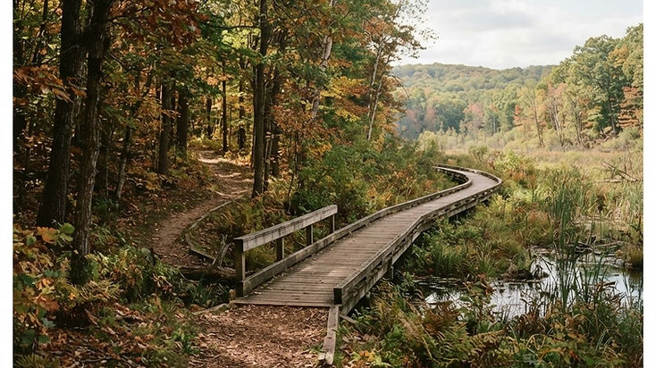
The trail winds through woodlands, wetlands and open natural areas near Wildwing Lake. Its extensive boardwalk offers views across the marshland along the lake's eastern shore and toward a heron rookery on the island, making it especially appealing to birdwatchers and photographers.
Despite its relatively short length, Wildwing includes steep sections, full-sun stretches and varied terrain. It feels like a genuine woodland hike rather than a simple walk around a park.
Visitor tip: Bring binoculars during spring and early summer for wildlife viewing. Stay on the trail and respect nesting birds.
The trail is compact gravel with wooden boardwalks and bridges. Pets, bicycles and running are not permitted on Kensington's nature trails, and the trails are not cleared or salted in winter.
Official source: Kensington Metropark Nature Center
Location: Milford area · Distance: 2 miles · Difficulty: Moderate
If you prefer dense woods to open lakeside scenery, Chickadee Trail is another excellent option at Kensington.
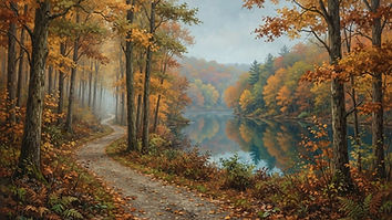
This shaded trail passes through dense forest with boardwalks, exposed tree roots and several steep portions. The woodland environment makes it particularly attractive during autumn when the leaves change color.
It's a good choice for hikers who want a short outing with more natural terrain underfoot.
Visitor tip: Wear shoes with traction, especially after rainfall. Roots and boardwalks can become slippery.
Chickadee is a two-mile compact gravel trail with boardwalks. Pets, bicycles and running are not permitted on the nature trails.
Official source: Kensington Metropark Nature Center
Location: Dexter · Distance: Roughly 2 miles · Difficulty: Easy
Hudson Mills Metropark is best known for its location along the Huron River, but the Acorn Nature Trail deserves attention of its own.
The trail winds through wooded habitat and areas near the river, offering opportunities to see seasonal wildflowers, birds and other wildlife.
With relatively little elevation change, it makes a comfortable outing for visitors who want to enjoy the forest without tackling a demanding route.
Visitor tip: Spring is a particularly appealing season for wildflowers. Pets, bicycles and running are prohibited on the designated nature trail.
Official source: Hudson Mills Metropark
Location: Shelby Township area · Distance: Variable · Difficulty: Moderate
For hikers looking for something more rugged, Stony Creek's Inwood Rustic Trails offer a different experience from the park's paved lake loop.
Located in the northern part of the Metropark, these primitive footpaths pass through natural woodland environments with narrow boardwalks, uneven terrain and areas that can become wet or muddy.
The trails are particularly appealing if you enjoy a quieter, less developed setting.
Visitor tip: Expect mud and obstacles. The park's designated nature trails exclude pets, bicycles and running; confirm the permitted uses on the Inwood paths with the current park map before you set out.
Official source: Stony Creek Metropark
Location: White Lake · Distance: Variable routes · Difficulty: Moderate
Haven Hill Natural Area is one of the most distinctive forest environments in Southeast Michigan.
Located within Highland Recreation Area, this protected natural area contains a diverse collection of forest types, including swamp forests, oak-hickory woods and mixed hardwood stands. It is also a National Natural Landmark.
The landscape is beautiful throughout the year, but spring wildflowers and autumn foliage make it particularly memorable.
Highland's rolling terrain also provides opportunities for a more physically engaging hike than many flatter Metro Detroit parks.
Visitor tip: Late April and early May are especially promising for wildflowers and migrating warblers. Use the official Highland trail map to select a designated hiking route.
Official sources: Haven Hill Natural Area and Highland Recreation Area
Location: Northville · Distance: Interconnected loops · Difficulty: Easy to moderate
Maybury State Park offers a surprising escape from the surrounding suburban landscape.
The park's hiking paths travel through woods, meadows and areas connected to its history as a former tuberculosis sanatorium property.
Rather than following one long trail, visitors can choose from interconnected hiking loops to create an outing that fits their available time and energy.
Visitor tip: Maybury has separate trail uses, including mountain biking and horseback riding. Follow current posted trail designations.
Trail work and seasonal closures can change which loops are open. Check the park's current advisories before visiting, and do not assume a project is finished.
Official source: Maybury State Park
Location: Pinckney · Distance: Long-distance options · Difficulty: Moderate to challenging
Pinckney Recreation Area is one of the best places in Southeast Michigan for hikers who want a longer adventure.
Its extensive trail network crosses rolling glacial terrain, forests and lake country. The Potawatomi Trail is particularly well known among outdoor enthusiasts, although it is a shared-use trail and not a hiking-only route.
The landscape makes Pinckney a strong choice for building hiking endurance and exploring routes that feel farther removed from the city.
Visitor tip: Start with a route you can comfortably complete and carry an official map. Trail reroutes and shared use make navigation awareness especially important.
Official source: Pinckney Recreation Area
Location: Chelsea · Distance: Multiple loops · Difficulty: Easy to moderate options
Waterloo Recreation Area offers some of the most extensive natural landscapes in southern Michigan.
The trails near the Gerald E. Eddy Discovery Center are especially appealing for visitors interested in geology, wildlife and the region's glacial history.
With multiple interconnected routes, hikers can choose shorter interpretive walks or combine trails for a longer outing.
Visitor tip: Visit the Discovery Center to learn about the area's landscape before heading out. Ask staff or check current park information when choosing a trail for specific accessibility needs.
Official source: Waterloo Recreation Area
Location: White Lake · Distance: Multiple short trails · Difficulty: Easy to moderate
Indian Springs Metropark offers a peaceful combination of forests, wetlands, prairie landscapes and interpretive nature trails.
The park's trails near the Environmental Discovery Center are especially interesting for visitors who enjoy learning about ecosystems while exploring outdoors.
Some routes include hills and slopes, while others closer to the park office are flatter and include boardwalk sections.
Visitor tip: Choose your starting area based on the terrain you prefer. Pets, bicycles and running are prohibited on the designated nature trails.
Official source: Indian Springs Metropark
Location: Commerce Township · Distance: Multiple routes · Difficulty: Easy to moderate options
Proud Lake Recreation Area combines woodland trails with the scenic Huron River corridor.
The landscape includes forests, open natural areas and river habitats, making it appealing for hikers who enjoy wildlife and changing scenery.
Its trail network supports multiple activities, including hiking, horseback riding and mountain biking, so visitors should pay attention to trail designations and shared-use areas.
For the full picture of the park's trail network, paddling access, camping, and visitor logistics, see our complete Proud Lake Recreation Area guide.
Visitor tip: Download the DNR nonmotorized trail map before visiting. Some routes may be shared with horses or bicycles.
Official source: Proud Lake Recreation Area
Location: Holly · Distance: Multiple routes · Difficulty: Moderate options
Holly Recreation Area offers a large landscape of rolling woodlands, open fields and inland lakes.
Its varied terrain makes it a worthwhile destination for hikers who want to explore beyond the flatter trails common in many suburban parks.
The recreation area also offers opportunities to combine a hike with camping or a longer day outdoors.
Visitor tip: Check the current trail map and construction advisories before visiting. Dam-repair work has affected lake recreation facilities at Holly in recent years, and advisories can change between seasons.
Official source: Holly Recreation Area
Location: Brighton · Distance: Multiple routes · Difficulty: Easy to moderate options
Island Lake Recreation Area is a favorite outdoor destination for good reason.
The park offers forests, open landscapes and the Huron River corridor, creating an attractive setting for walking, hiking, cycling and paddling.
Hikers can explore designated routes through the recreation area while enjoying a landscape that feels surprisingly natural given its proximity to major highways and nearby communities.
Visitor tip: Check trail-use designations and the official park map. Some routes are shared with cyclists or other users, and not every access point leads to the same trail.
Official source: Island Lake Recreation Area
Location: Howell and Brighton area · Distance: Multiple routes · Difficulty: Moderate options
Brighton Recreation Area is a beautiful place to explore the rolling terrain left behind by Michigan's glaciers.
The park contains wooded hills, lakes and recreation areas that create opportunities for hikers seeking changing scenery and more elevation than a typical paved park path.
It's particularly appealing in autumn when the surrounding hardwood forests change color.
Visitor tip: Select a designated hiking route before arriving, as Brighton contains multiple recreation facilities and trail systems with different permitted uses.
Official source: Brighton Recreation Area
Location: Shelby Township area · Distance: 3.5-mile network · Difficulty: Easy to moderate options
Stony Creek's East Lake Nature Trails offer a wonderful alternative to the park's busier paved loop.
This network consists of four connected trails marked with directional arrows: the half-mile Reflection Trail, the one-mile Landscape Trail and the 2.5-mile Habitat Trail, together roughly 3.5 miles. They cross forests, wetlands and a landscape shaped by glaciers.
The variety makes the area especially interesting for nature enthusiasts who enjoy learning about the landscape as they hike.
Visitor tip: Use the official nature-trail map to select your route. Pets, bicycles and running are prohibited on the designated nature trails.
The trails are compact gravel, bare soil and mowed grass, with steep inclines, three wooden bridges and a plank bridge without side rails.
Official source: Stony Creek Metropark Nature Center
Location: Milford area · Distance: 1.5 miles · Difficulty: Easy
Aspen Trail is a lovely choice for a shorter, relaxed hike through a mixture of habitats.
The route passes through prairie, wetland and forest environments, with boardwalks and wooden bridges along the way.
Wildflowers, birdlife and the remains of a historic homestead give the trail several interesting features beyond the scenery.
A shortcut also allows visitors to shorten the loop to approximately one mile.
Visitor tip: This is an appealing choice for spring and summer wildflowers. Parts of the route are exposed to full sun, so bring water on warm days.
Official source: Kensington Metropark Nature Center
Different trails suit different days. Use this as a starting point, then confirm distance, surface and rules on the official map.
| Hiking experience | Recommended trails |
|---|
| Short, scenic nature walk | Aspen, Wildwing, Acorn |
| Woodland hiking | Chickadee, Maybury, Haven Hill |
| Longer or more demanding routes | Pinckney, Highland, Waterloo |
| Wetlands and wildlife | Wildwing, Indian Springs, East Lake |
| Rugged natural terrain | Inwood Rustic Trails |
| Family-friendly options | Acorn, Aspen, selected Waterloo loops |
| Autumn colors | Haven Hill, Maybury, Brighton |
Difficulty descriptions are editorial guidance, not standardized official ratings. Trail conditions and route choices can change the effort required.
Download an official trail map. Many recreation areas contain multiple trail systems with separate parking locations.
Check current closures. Construction, flooding, erosion and seasonal maintenance can change trail access.
Know the trail rules. Some nature trails prohibit dogs, bicycles or running, while other routes are shared with mountain bikers or horses.
Prepare for mud and insects. Spring and early summer can bring wet trails, mosquitoes and ticks.
Dress for the season. Autumn and winter hikes can be beautiful, but shorter daylight hours and icy boardwalks require preparation.
Check hunting seasons. Some state recreation areas allow hunting in designated locations. Wear visible clothing and consult current park regulations.
Trail access, conditions, restrictions and closures may change. Always check the official managing-agency map and current advisories before visiting.
Maybury State Park, Stony Creek Metropark, Proud Lake Recreation Area and Highland Recreation Area are excellent starting points, depending on your location and preferred terrain.
Pinckney Recreation Area, Highland Recreation Area and Waterloo Recreation Area offer longer routes and more varied terrain. Always select a route that matches your experience.
Kensington Metropark's Wildwing, Chickadee and Aspen trails are strong choices. Proud Lake, Highland and Indian Springs are also worth exploring.
Yes. Hudson Mills' Acorn Trail, Kensington's Aspen Trail and selected Discovery Center trails at Waterloo offer approachable options. Check trail surfaces and accessibility details for individual needs.
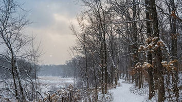
Yes, many trails remain available for winter recreation, but maintenance varies. Nature trails are not cleared or salted in winter at several Metroparks, and snow or ice may make them hazardous.
Southeast Michigan has an incredible variety of hiking opportunities hiding in plain sight.
You can walk through wetlands on a wooden boardwalk, explore rolling forested hills, follow trails near the Huron River or spend an afternoon discovering a quiet natural area only minutes from home.
The best part is that you don't need an elaborate vacation to experience them.
Pick a trail, pack some water, bring a map and get outside.
Your next favorite Michigan hiking destination might be closer than you think.