
HikingCampingNov 14, 2026
The Best Weekend Outdoor Adventures in Southeast Michigan
Discover 12 unforgettable outdoor adventures in Southeast Michigan, including hiking, kayaking, camping, biking, fishing and scenic weekend escapes.
Read the guideExplore Michigan
Discover Michigan’s incredible outdoor destinations, from scenic hiking trails and peaceful campgrounds to kayaking adventures, mountain biking routes, state parks, and weekend getaways.
Explore practical guides, discover new places, and plan your next adventure.
Start here
The guides readers use most to plan a day out or a weekend away.
Discover 12 unforgettable outdoor adventures in Southeast Michigan, including hiking, kayaking, camping, biking, fishing and scenic weekend escapes.
Read the guide
From peaceful forest trails and hidden lakes to scenic rivers and Lake Erie beaches, discover twelve incredible outdoor destinations across Southeast Michigan.
Read the guide
Explore 15 incredible hiking trails in Southeast Michigan, from quiet woodland paths to scenic lakes, boardwalks, rolling hills and nature preserves.
Read the guide
Discover 12 beautiful places to kayak and canoe in Southeast Michigan, from the Huron River to quiet lakes, with launch tips, rentals and safety guidance.
Read the guide
Discover 12 incredible mountain biking destinations in Southeast Michigan, from beginner-friendly singletrack to technical trails, flow loops and forest rides.
Read the guideThe collection
Showing 30 of 30 guides.

Beaches that stretch for miles, towering pines, Upper Peninsula waterfalls, and Lake Michigan dunes: ten Michigan state parks worth building a trip around.
Read the guide
Tent sites beside Lake Superior, family campgrounds along Lake Michigan, and quiet forest retreats: twelve Michigan camping destinations worth building a trip around.
Read the guide
Lake Superior cliffs, waterfalls, Sleeping Bear dunes, and quiet forest trails close to home: fifteen Michigan hikes worth building a trip around.
Read the guide
Flowing Michigan singletrack, technical Upper Peninsula rock, and quiet forest loops: twelve mountain biking destinations worth planning a ride around.
Read the guide
Explore ten lesser-known rustic Michigan campgrounds, including Lake Superior shoreline retreats, forest lakes, and small riverfront camping destinations.
Read the guide
From powerful Upper Peninsula waterfalls to peaceful forest cascades, discover twelve unforgettable places to experience Michigan's natural beauty on foot.
Read the guide
From Lake Superior beaches and dramatic mountain forests to peaceful inland lakes and remote rivers, discover twelve unforgettable camping destinations across Michigan’s Upper Peninsula.
Read the guideFrom peaceful forest trails and hidden lakes to scenic rivers and Lake Erie beaches, discover twelve incredible outdoor destinations across Southeast Michigan.
Read the guideDiscover 12 beautiful places to kayak and canoe in Southeast Michigan, from the Huron River to quiet lakes, with launch tips, rentals and safety guidance.
Read the guideExplore 15 incredible hiking trails in Southeast Michigan, from quiet woodland paths to scenic lakes, boardwalks, rolling hills and nature preserves.
Read the guideDiscover 12 incredible mountain biking destinations in Southeast Michigan, from beginner-friendly singletrack to technical trails, flow loops and forest rides.
Read the guideDiscover 12 unforgettable outdoor adventures in Southeast Michigan, including hiking, kayaking, camping, biking, fishing and scenic weekend escapes.
Read the guide
Michigan campgrounds do not all close for the winter. Here are six places to research for a cold-weather trip, plus the gear, safety, and cabin options that make a January night outside worth it.
Read the guide
From wooded campsites near Milford to Lake Huron shorelines and Huron River paddle-in sites, discover 12 Southeast Michigan camping destinations for your next outdoor getaway.
Read the guide
Discover Proud Lake Recreation Area near Milford, Michigan, with this complete guide to wooded hiking trails, Huron River kayaking, lakeside camping, wildlife, family activities and weekend adventures.
Read the guide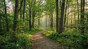
Ten scenic nature walks near Milford, Michigan, across six park destinations — from the Wildwing boardwalks and Proud Lake forest to prairie loops, swamp trails, and lakeside paved paths.
Read the guide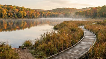
Discover two incredible Southeast Michigan parks in one day. Explore Kensington's lakeside trails and wildlife, then head to Island Lake for forests, river scenery, and outdoor adventure.
Read the guide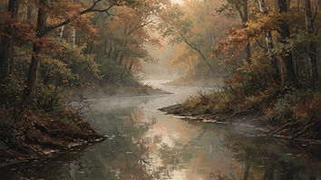
From Proud Lake and Milford to Dexter and Ann Arbor, discover how to plan a Huron River paddling adventure with practical launch information, route options, and essential safety guidance.
Read the guide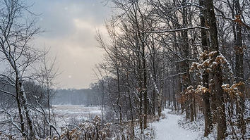
Winter transforms Southeast Michigan's forests, wetlands, and lakes into beautiful outdoor destinations. Explore 12 places worth hiking, with practical advice for snow, ice, trail conditions, and winter safety.
Read the guide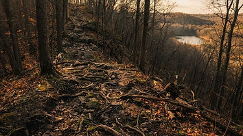
Looking for a tougher trail? Explore ten challenging hikes across Southeast Michigan, from steep woodland climbs to long-distance backpacking adventures.
Read the guide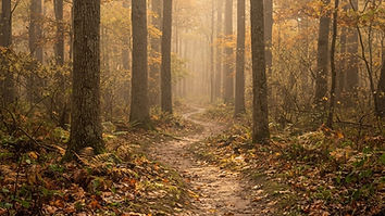
Explore ten peaceful parks and nature preserves across Oakland County, from wooded trails near Milford to lakeside walks and hidden natural spaces near Rochester.
Read the guide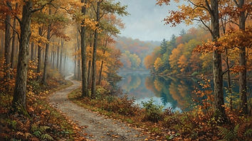
Explore twelve scenic fall hiking destinations across Southeast Michigan, featuring colorful woodlands, lakeside trails, glacial hills, and peaceful nature walks.
Read the guide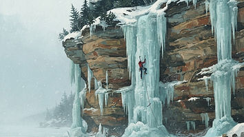
Explore Michigan ice climbing, from beginner instruction near Fenton to natural ice formations around Pictured Rocks, with essential equipment, access, and safety guidance.
Read the guide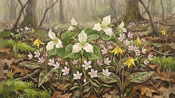
Explore twelve beautiful spring walks across Southeast Michigan, from woodland wildflowers and vernal pools to gardens, wetlands, and peaceful nature trails.
Read the guide
Ten paddling areas across Southeast Michigan, with launch and take-out planning, river route advice, beginner-friendly lakes, shuttle logistics, and summer safety essentials.
Read the guide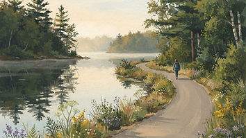
Ten lakeside walks across Southeast Michigan, from loop trails at Kensington and Stony Creek to shoreline paths on Lake St. Clair and Lake Erie, with route tips.
Read the guide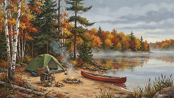
Plan an unforgettable Michigan fall camping trip with twelve scenic destinations, campground guidance, autumn-color timing, and practical tips for colder weather.
Read the guide
Ten Michigan snowshoeing destinations, from Kensington and Stony Creek to Tahquamenon Falls and the Porcupine Mountains, with winter trail rules, gear guidance, and cold-weather safety.
Read the guide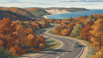
Discover twelve scenic drives across Michigan, from Southeast Michigan day trips to Great Lakes shorelines, northern forests, and Upper Peninsula adventures.
Read the guide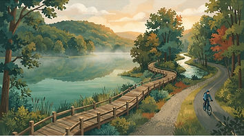
A local guide to the best outdoor adventures around Milford, from wooded hiking trails and the Huron River to lakes, camping, biking, and seasonal escapes.
Read the guideThe Adventure Map
Explore Michigan destinations on an interactive map, discover nearby parks and recreation areas, and find outdoor experiences that match your interests.
Activity
Region
Difficulty (trails only)
Season
Seasons are verified against each managing agency. Destinations still awaiting seasonal review appear under All Seasons only.
44 of 122 destinations
Southeast Michigan · Oakland County
An Oakland County park near Leonard with wooded singletrack, rolling terrain, a campground and separate trails for other uses.
This access point is documented by the managing agency, but turn-by-turn coordinates are not yet verified.
Southeast Michigan · St. Clair County
St. Clair River campgrounds known for close-up views of passing freighters, with a riverfront modern campground, a wooded wagon-wheel campground, a group-use area and a large dedicated natural area.
Southeast Michigan · Washtenaw County
An Ann Arbor city park on the Huron River with a seasonal canoe livery, Argo Pond and the Argo Cascades whitewater channels.
This access point is documented by the managing agency, but turn-by-turn coordinates are not yet verified.
Southeast Michigan · Oakland County
About 4,600 acres near Lake Orion in separate North and South units, offering the steepest hiking terrain in the region, inland lakes, fishing, swimming and a floating water park in season. Multiple entrances.
This access point is documented by the managing agency, but turn-by-turn coordinates are not yet verified.
Southeast Michigan · Oakland County
A 107-acre Oakland Township park protecting hardwood forest, Bear Creek Marsh, vernal pools, and open fields. Boardwalks, mowed paths, and ADA-accessible limestone trails reach the forests, meadows, and wetlands; parking is at the Snell Road entrance and Township Hall, with a pedestrian entry on Gunn Road.
Entrance directions are not yet verified. Check the official park map before traveling.
Southeast Michigan · Livingston County
Nearly 5,000 acres across Livingston County with nine lakes, wooded hills, marshes and separate hiking, mountain biking and equestrian trail systems, plus camping and swimming in season.
This access point is documented by the managing agency, but turn-by-turn coordinates are not yet verified.
Southeast Michigan · Washtenaw County
A Washtenaw County park in Ann Arbor that includes the Britton Woods Nature Area, a woodland with upland and floodplain tree species. The county identifies trilliums and other spring woodland wildflowers in Britton Woods.
Other access points are documented but not yet routable. Confirm conditions with the managing agency before traveling.
Southeast Michigan · Oakland County
A 213-acre Oakland Township park between Predmore and Romeo roads with about 2.1 miles of mowed and limestone trails through forests, fields, and habitat near the lake, plus a historic farm district whose buildings are viewable during scheduled tours or from the road.
Entrance directions are not yet verified. Check the official park map before traveling.
Southeast Michigan · Washtenaw County
A Huron-Clinton Metropark on a quiet bend of the Huron River near Ann Arbor, with mature oak stands, paved trails, and canoe and kayak access. The park address is 3902 E. Delhi.
Confirm conditions with the managing agency before traveling.
Southeast Michigan · Oakland County
A 90-acre Oakland Township park protecting the easterly Twin Lake, rolling topography, open wetlands, and prairie plantings. A 0.4-mile limestone path leads toward the water, and more than a mile of mowed paths on the east side link Inwood Road with the Hadden and Inwood roads area.
Entrance directions are not yet verified. Check the official park map before traveling.
Southeast Michigan · Oakland County
A 234-acre Oakland Township preserve acquired in 2022, immediately west of Lost Lake Nature Park. From the parking lot at 1627 West Predmore Road, 1.3 miles of mowed trails cross fields, oak woodlands, wetland habitats, and parts of the Stony Creek watershed.
Entrance directions are not yet verified. Check the official park map before traveling.
Southeast Michigan · Washtenaw County
An Ann Arbor city park along the Huron River with a seasonal livery, still-water paddling and accessible launch facilities.
This access point is documented by the managing agency, but turn-by-turn coordinates are not yet verified.
Southeast Michigan · Oakland County
A 302-acre Oakland County park of rolling hills, wetlands, and old pastures with 2.5 miles of trails for hiking, horseback riding, and cross-country skiing, plus fishing from an accessible floating dock. Archery deer hunting is allowed in designated areas.
Entrance directions are not yet verified. Check the official park map before traveling.
Southeast Michigan · Oakland County
Technical cross-country singletrack on wooded, rolling terrain with a published mountain bike map.
This access point is documented by the managing agency, but turn-by-turn coordinates are not yet verified.
Southeast Michigan · Oakland County
More than 8,000 acres of rolling woodlands and open fields between Pontiac and Flint, with Heron, Valley, Wildwood and Crotched lakes, a swim beach, boat launch, disc golf, paddling and the McGinnis Lake modern campground. Dam repairs in 2026 lowered lake levels and closed the floating water park for that season.
This access point is documented by the managing agency, but turn-by-turn coordinates are not yet verified.
Southeast Michigan · Washtenaw County
A metropark on the Huron River corridor near Dexter, used as a launch or takeout for downstream paddling and river trips.
This access point is documented by the managing agency, but turn-by-turn coordinates are not yet verified.
Southeast Michigan · Livingston
A Huron-Clinton Metropark of more than 1,500 acres at 8765 Hammel Road in Brighton, with woodland and wetland trails, fishing on Maltby Lake and the Huron River from an accessible pier and observation deck at the Sunset Ridge picnic area, a par-72 golf course, and groomed cross-country ski trails in winter, including the 1.5-mile Bucks Run loop from the Ski Center. A daily or annual vehicle pass is required. The stored coordinate is the mapped location of the park’s published address rather than a surveyed entrance, so directions are withheld until an entrance point is verified.
This access point is documented by the managing agency, but turn-by-turn coordinates are not yet verified.
Southeast Michigan · Oakland County
Oakland County’s largest park at 1,286 acres, with more than 12 miles of natural and paved trails around 68-acre Crooked Lake, a portion designated old-growth forest, and the Wint Nature Center. Winter access and any ski-specific trail designations should be confirmed on the current park map.
Entrance directions are not yet verified. Check the official park map before traveling.
Southeast Michigan · Oakland County
A metropark near White Lake with forests, wetlands, prairie and interpretive nature trails around its Environmental Discovery Center.
This access point is documented by the managing agency, but turn-by-turn coordinates are not yet verified.
Southeast Michigan · Livingston County
Roughly 4,000 acres of forest, meadows, inland lakes and frontage on the Huron River near Brighton, with camping, a swim beach, mountain biking and a paved connection toward Kensington Metropark and the Huron Valley Trail. Multiple access points.
Confirm conditions with the managing agency before traveling.
Southeast Michigan · Oakland County
A large regional metropark built around Kent Lake, with open-water paddling, seasonal boat rentals and shoreline trails within a short drive of Metro Detroit.
This access point is documented by the managing agency, but turn-by-turn coordinates are not yet verified.
Southeast Michigan · Wayne County
A 1,607-acre Huron-Clinton Metropark on Lake Erie in Brownstown Township, with three miles of shoreline, paved and nature trails, and the Marshlands Museum. The 1.25-mile Cherry Island Nature Trail loops through coastal marsh and boardwalk.
Other access points are documented but not yet routable. Confirm conditions with the managing agency before traveling.
Southeast Michigan · Macomb County
A metropark on the Lake St. Clair shoreline with marsh habitat, birdwatching and open-water paddling that demands caution in wind and waves.
This access point is documented by the managing agency, but turn-by-turn coordinates are not yet verified.
Southeast Michigan · Oakland County
A roughly 58-acre Oakland Township park just east of Fox Nature Preserve, protecting a glacial lake, wetlands, and open oak woodland. A 0.3-mile rustic trail and an observation dock pair with the Lost Lake Nature Center, which opens for scheduled programs.
Entrance directions are not yet verified. Check the official park map before traveling.
Southeast Michigan · Wayne County
A metropark along the lower Huron River corridor with wooded banks, meadows and river trails south of the Milford and Dexter stretches.
Entrance directions are not yet verified. Check the official park map before traveling.
Southeast Michigan · Oakland County
A 1,041-acre Oakland County park that preserves 800 acres of environmentally sensitive wetlands, with about six miles of natural trails used for walking, biking, cross-country skiing, and on-leash dog walking.
Southeast Michigan · Washtenaw County
University of Michigan botanical gardens on North Dixboro Road in Ann Arbor, with display gardens, a conservatory and trails such as the Sam Graham Trees Trail through Michigan natural communities.
Confirm conditions with the managing agency before traveling.
Southeast Michigan · Wayne County
Wooded trails minutes from Detroit, with a separate mountain bike trail renovated in 2026.
Entrance directions are not yet verified. Check the official park map before traveling.
Southeast Michigan · Oakland
A 12-acre Village of Milford park in the heart of the community, within easy walking distance of downtown, on the Huron River and Pettibone Creek. It has a playscape, tennis and pickleball court, basketball courts, sand volleyball court, a pavilion available first come first served, the LaFontaine Family Amphitheater and its summer concert series, the Veterans’ Memorial, and restrooms open approximately 7:30 a.m. to 9 p.m. Two canoe and kayak access points opened with the park’s August 2024 reopening: "On the Point" at the entrance to Pettibone Creek, and a load and unload point on Pettibone Creek near the footbridge and parking lot. Riverbanks, dam structures and private shoreline property outside the park are not public access.
This access point is documented by the managing agency, but turn-by-turn coordinates are not yet verified.
Southeast Michigan · Oakland
A paved multiuse trail connecting the Village of Milford with Kensington Metropark through the Huron River valley. The local trail organization describes the route from the YMCA area to the Kensington entrance near the Dairy Queen as approximately 3.6 miles; other trail directories measure a longer corridor using different endpoints, so the total distance depends on where you begin and finish. This is a trail corridor, not a park: the pin marks a point on the corridor and does not represent a trailhead or the whole route, and it is not Kensington Metropark. Watch for cyclists, road crossings and changes in grade, and check current construction and surface conditions before planning a long connected ride.
Trail difficulty · Easy
This access point is documented by the managing agency, but turn-by-turn coordinates are not yet verified.
Southeast Michigan · Washtenaw County
University of Michigan arboretum along the Huron River in Ann Arbor, with nearly 3.5 miles of trails through wooded hills, natural areas and flowering plant collections. Entrances are documented at Washington Heights, Nichols Drive and Geddes Road.
Other access points are documented but not yet routable. Confirm conditions with the managing agency before traveling.
Southeast Michigan · Wayne County
A 1,756-acre Huron-Clinton Metropark along the Huron River near New Boston, with mature woodlands, a nature center and nature trails. The park address is 32911 Willow Road.
Confirm conditions with the managing agency before traveling.
Southeast Michigan · Oakland County
Oakland County park in Orion Township with natural-surface trails used for winter hiking and snowshoeing. Trail surface is ungroomed, and winter access and parking should be confirmed with the park before visiting.
Entrance directions are not yet verified. Check the official park map before traveling.
Southeast Michigan · Washtenaw County
Wooded hills and lakes west of Ann Arbor, home of the Potawatomi Trail and Silver Lake campground.
This access point is documented by the managing agency, but turn-by-turn coordinates are not yet verified.
Southeast Michigan · Oakland County
Long-established mountain bike loop through rolling woods west of Pontiac.
Confirm conditions with the managing agency before traveling.
Southeast Michigan · Huron
A state park on three miles of sandy Lake Huron shoreline at the tip of Michigan’s Thumb, just outside Port Austin. It has a 142-site modern campground, camper cabins, cottage cabins and geodesic domes, a designated dark-sky preserve with a viewing platform near Parking Lot D, a carry-in boat launch on the Pinnebog River, trails, cross-country skiing and snowshoeing. The DNR notes that the day-use area and the campground and overnight lodging are two miles apart with separate entrances, so a single pin cannot represent both; turn-by-turn directions are withheld and the published address is offered instead.
This access point is documented by the managing agency, but turn-by-turn coordinates are not yet verified.
Southeast Michigan · Oakland County
About 3,000 acres along the Huron River and Proud Lake, 40 minutes from downtown Detroit. Four boating access sites, canoe and kayak rentals, a Type I trout stream, equestrian trails, and a 130-site modern campground with mini cabins and camper cabins.
Other access points are documented but not yet routable. Confirm conditions with the managing agency before traveling.
Southeast Michigan · Oakland County
A 649-acre undeveloped Oakland County park near Holly with about five miles of trails through glacier lakes, meadows, and wooded uplands, shared by hikers, cyclists, equestrians, and cross-country skiers. General parking is on Buckhorn Lake Road; the equestrian lot is on Fish Lake Road.
Entrance directions are not yet verified. Check the official park map before traveling.
Southeast Michigan · Oakland County
A 1,434-acre park with more than 230 acres of water across six lakes, including Big Seven, Dickinson, Little Seven, Spring, Mud and Sand lakes. Buoyed swim area and boat launches on Big Seven Lake, an accessible fishing pier on Dickinson Lake, and a 70-site modern campground on Sand Lake.
Confirm conditions with the managing agency before traveling.
Southeast Michigan · Clinton
A 2,600-acre Michigan state park centered on 410-acre Lake Ovid, about 20 minutes north of Lansing. The park has a modern campground, two cabins, a swim beach with a beach house, an accessible boat launch and a kayak launch on a no-wake lake, four fishing piers, an 18-hole disc golf course, and more than 12 miles of equestrian trails with a staging area. A Recreation Passport is required for vehicle entry. The stored coordinate is the park reference point published in the DNR management plan, not a surveyed entrance: the entrance is on E. Price Road, and turn-by-turn directions are withheld until an entrance point is verified.
This access point is documented by the managing agency, but turn-by-turn coordinates are not yet verified.
Southeast Michigan · Macomb County
A metropark centred on Stony Creek Lake, offering open-water paddling, seasonal paddlesport rentals and shoreline trails on the eastern side of Metro Detroit.
This access point is documented by the managing agency, but turn-by-turn coordinates are not yet verified.
Southeast Michigan · Oakland County
A 268-acre Oakland Township preserve protecting the stream valley of the West Branch of Stony Creek, oak forest, restored wetlands, and prairie. Nearly two miles of trails; pedestrian access only. Planned parking, trailhead, and Metropark connection are not yet confirmed as open. The park closes during controlled hunts on Tuesdays and Wednesdays, October 1 through January 31.
Entrance directions are not yet verified. Check the official park map before traveling.
Southeast Michigan · Jackson County
The largest state park in Michigan's Lower Peninsula, spanning tens of thousands of acres of glacial terrain near Chelsea. Trailhead for the Waterloo-Pinckney Trail, home to the DTE Energy Foundation Trail system and the Gerald E. Eddy Discovery Center, with campgrounds and lakes throughout.
This access point is documented by the managing agency, but turn-by-turn coordinates are not yet verified.
Southeast Michigan · Monroe County
Michigan’s only state park on Lake Erie, near Monroe, with about a mile of sandy shoreline, extensive marshes and restored coastal habitat, a modern campground, fishing, cycling and the River Raisin Heritage Trail connection.
Confirm conditions with the managing agency before traveling.
More on bradmerritt.com
Privacy
This site uses privacy-respecting first-party analytics to understand which pages are useful. If a page shows advertising, it is served by Google and sets cookies only when you accept. No personal details are collected.
Read the privacy notice


