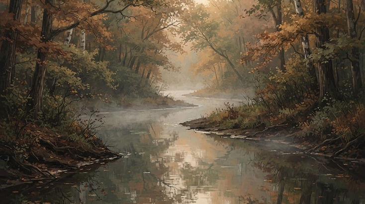
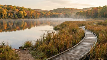
Before picking a launch point, decide what kind of experience you're looking for.
A quiet paddle through wetlands is very different from a downstream river trip. Both can be wonderful, but they require different planning.
| Experience | Good Starting Area | Planning Considerations |
|---|
| Beginner-friendly, sheltered paddling | Proud Lake and Moss Lake | Check water levels and access |
| Short downstream trip | Proud Lake to Milford | Arrange take-out transportation |
| Lake exploration | Kent Lake | Wind, boat traffic, and return distance |
| Longer scenic river trip | Hudson Mills to Delhi | Shuttle, time, and river conditions |
| Urban park paddling | Argo and Gallup area | Launch access, cascades, and local rules |
These are planning categories, not guarantees of safe conditions. The official Water Trail publishes recommended routes and current advisories that should guide your final choice.
For paddlers in the Milford area, Proud Lake Recreation Area is a natural place to begin.
Here, the Huron River winds through marshes, tree-lined banks, and quiet stretches of water. It's the beginning of the designated Huron River Water Trail and one of its more approachable sections.
The official Water Trail identifies two useful outings:
- Proud Lake recreation area paddle: approximately 2.8 miles, with an estimated paddling time of 1.5 hours.
- Proud Lake to Milford: approximately 2.3 miles, with an estimated paddling time of one hour.
Both are described as relatively easy trips for novice paddlers under suitable conditions. The times are official planning estimates, not guaranteed completion times.
Officially identified access options in the Proud Lake area include the campground boat launch and the access site on the north side of Proud Lake.
The exact choice depends on whether you're paddling a loop, exploring the lake, or traveling downstream toward Milford.
For a downstream trip toward Milford, Central Park is a recognized river access area. Before launching, confirm its current access conditions and your intended exit point on the official Water Trail map.
If you're paddling without a second vehicle, consider a sheltered out-and-back route instead of committing to a one-way trip.
Proud Lake feels removed from the surrounding suburbs. Wetlands and wooded shorelines make the journey interesting even when you're not covering many miles.
It's a strong choice for wildlife observation, relaxed paddling, and learning to handle a kayak on gently moving water.
Milford offers something many paddling destinations don't: an opportunity to combine river recreation with a walkable downtown.
The Huron River Water Trail passes near Central Park, making Milford a useful stopping point for certain trips. Nearby Kensington Metropark surrounds Kent Lake, one of the area's most recognizable paddling destinations.
Kent Lake offers approximately five miles of flatwater paddling area, with bays and shoreline features to explore. The official Water Trail identifies multiple access points in Kensington Metropark and an access point from Island Lake Recreation Area.
Unlike a narrow river corridor, however, open lake water can be affected significantly by wind.
A pleasant morning paddle may become a difficult return trip if the wind increases while you're on the far side of the lake.
Choose a route that matches your abilities, stay aware of boat traffic, and avoid committing to a long crossing when conditions are unfavorable.
Kent Lake works well when you want to paddle without arranging a downstream vehicle shuttle.
You can explore part of the shoreline and return to your original launch, provided conditions and the access rules allow it.
For a combined land-and-water day, Kensington's trails and picnic areas make it easy to extend the outing beyond kayaking.
Downstream of Kensington, the Huron passes through Island Lake Recreation Area, where the scenery shifts between marshland, wooded banks, and stretches of river beneath the tree canopy.
It's an attractive destination for paddlers who want a more natural river experience.
But some downstream sections are less traveled and can contain fallen trees or other obstructions.
The official Water Trail specifically warns that the stretch toward Huron Meadows can require maneuvering around natural barriers.
A route through Island Lake shouldn't be selected solely because it looks short on a map.
Consider whether your group can safely handle moving water, whether the take-out is accessible, and whether there are current obstructions.
In 2026, bridge construction near McCabe Road has also affected river access downstream of Island Lake, with additional closure periods identified by the Water Trail. Check the live closure notices before choosing this area.
For newer paddlers, a shorter outing with a clear return plan may be a better option than an unfamiliar downstream route.
For paddlers ready to spend several hours on the water, the stretch from Hudson Mills Metropark toward Delhi Metropark is one of the Huron River's standout routes.
The official Water Trail lists:
Hudson Mills to Delhi
- Distance: approximately 9.5 miles.
- Estimated paddling time: approximately 3.5 hours.
- Character: scenic downstream paddling through the Dexter area.
This is a longer commitment than the Proud Lake outings, so transportation and timing matter.
Start by confirming the official launch at Hudson Mills and the intended take-out in the Delhi area.
Arrange a vehicle shuttle or an outfitter service before launching. Don't assume you can comfortably paddle back upstream after several hours of downstream travel.
The route is described by the Water Trail as not requiring a portage on its recommended alignment, but conditions can change. Check current notices and avoid continuing into Delhi Rapids unless you have the necessary skills and have confirmed a safe route.
The river flows through a landscape of wooded banks, natural scenery, and relatively limited development in places.
It's the kind of outing where the journey itself becomes the attraction.
Bring enough water and food for a longer trip, allow extra time for breaks, and avoid planning your take-out too close to sunset.
Farther downstream, the river becomes part of Ann Arbor's outdoor recreation network.
Argo Park and Gallup Park provide access to paddling areas near city parks, trails, and neighborhoods.
For visitors who don't own a kayak, the city's liveries can be useful places to investigate equipment rentals and guided logistics.
The official Water Trail lists an Argo-to-Gallup trip of approximately 3.5 miles, with an estimated paddling time of 1.5 hours.
However, this route can involve the Argo Cascades, a constructed whitewater feature. It should not be treated as an ordinary flatwater trip or an automatic beginner recommendation.
If you're unfamiliar with moving-water features, ask the operating livery about the appropriate route and current conditions.
For a more relaxed experience, investigate permitted flatwater paddling on Argo Pond or Geddes Pond.
As of November 2026, the Huron River Water Trail reports that the Barton Dam portage and associated access areas remain closed during construction, with the closure listed through 2027.
Do not plan a continuous trip through Barton Dam or rely on an older map showing the portage as open.
The most common mistake in river trip planning is choosing a launch point without deciding where the trip will end.
On a river, the current may help carry you downstream. But that doesn't mean getting back to your car will be easy.
Use the official Huron River Water Trail Trip Planner:
https://huronriverwatertrail.org/trip-planner/
Identify a route appropriate for your experience.
Check the distance, estimated duration, access points, hazards, and whether a portage is required.
Confirm that your put-in and take-out are currently open, legal, and accessible.
Check whether the access requires a park admission pass, has restricted hours, or involves carrying your boat a significant distance.
For a one-way trip, you generally have three options: bring two vehicles, arrange a shuttle with an outfitter, or coordinate pickup with someone who isn't paddling.
If none of those options is available, consider an appropriate out-and-back route on sheltered water instead.
Look at recent rainfall, water levels, current speed, wind, and weather.
A river section that was manageable last weekend may be dangerous after heavy rain or obstructed by newly fallen trees.
Before launching, decide what conditions would cause you to cancel.
High water, thunderstorms, strong wind, cold water, closures, or uncertainty about a required portage are all legitimate reasons to choose another day.
Use the interactive map associated with this article to explore the following areas:
- Proud Lake Recreation Area.
- Central Park, Milford.
- Kensington Metropark and Kent Lake.
- Island Lake Recreation Area.
- Hudson Mills Metropark.
- Delhi Metropark.
- Argo Park.
- Gallup Park.
The map is a location overview, not a navigable paddling route.
Consult official water trail maps for river-mile positions, launch details, portages, and current access restrictions.
The Huron River is not one continuous stretch of unobstructed water.
Dams, rapids, constructed features, and changing natural conditions can make some sections unsuitable for inexperienced paddlers.
A portage is the act of getting out of the water and carrying or moving your boat around an obstacle before launching again.
Some portages are straightforward. Others involve steep banks, stairs, difficult footing, or closures.
Never approach a dam expecting to paddle over it.
The Water Trail's 2026 conditions page identifies several important restrictions:
| Location | Reported Issue |
|---|
| McCabe Road area | Bridge construction and intermittent river closures |
| Flook Dam | Portage closed for the 2026 paddling season |
| Barton Dam | Access and portage closed through 2027 |
| French Landing Dam | Downstream portage stairs closed until further notice |
These are dated notices, not permanent predictions.
Recheck the official River Conditions page before every trip:
https://huronriverwatertrail.org/river-conditions/
- A properly fitted life jacket, worn throughout the trip.
- A suitable kayak or canoe, paddle, and appropriate safety equipment.
- Water, snacks, sun protection, and weather-appropriate clothing.
- Secure dry storage for your phone, keys, and spare clothing.
- River footwear that can handle slippery or rocky surfaces.
- An offline map and a confirmed transportation plan.
- A trip plan shared with someone who knows when to expect you back.
The Huron River Water Trail emphasizes properly fitted life jackets, awareness of strainers and other hazards, and matching your route to your abilities.
A strainer is especially dangerous: it's a fallen tree, branch pile, or other obstruction that allows water through but can trap a person or boat.
Never assume you can safely paddle through or beneath one.
Emerging greenery and wildlife activity make spring appealing, but rainfall, higher flows, and cold water demand caution.
Warmer air and longer daylight make summer popular. Expect more recreational traffic and occasional low-water conditions.
Colorful riverbanks and quieter waterways can make fall particularly memorable. Shorter days and colder water require additional planning.
Winter paddling requires specialized cold-water equipment, experience, and rescue planning. It should not be approached as a casual extension of summer kayaking.
Some sections are well suited to newer paddlers under appropriate conditions, including sheltered Proud Lake outings. Other sections involve rapids, obstructions, dams, or long distances. Choose by route and current conditions, not by the river's overall reputation.
Yes, the official Water Trail identifies a roughly 2.3-mile downstream trip from the Proud Lake area to Milford. Verify current launch and take-out access and arrange transportation.
The designated trail is approximately 104 miles. Completing it requires multi-day logistics, transportation, portage planning, and careful attention to closures. Current construction restrictions may prevent a continuous through-paddle.
Not necessarily. Outfitters and liveries serve portions of the Huron River, including the Dexter and Ann Arbor areas. Rental availability and transportation services vary, so confirm directly before planning your trip.
No single measurement can guarantee safety. Review the Water Trail's current conditions, weather forecasts, flow data, closure notices, and hazards. Choose a route within your skills and cancel when conditions are uncertain.
Yes, water-quality advisories can apply. Check the Water Trail and Michigan environmental agencies for current PFAS and other notices. Avoid ingesting river water or foam, and follow current fish-consumption guidance.
The Huron River offers something special: a connected outdoor experience that runs through the heart of Southeast Michigan while still providing stretches that feel surprisingly remote.
You can begin with a short paddle through Proud Lake's wetlands. Explore Kent Lake on a calm morning. Spend a longer day between Hudson Mills and Delhi. Or discover Ann Arbor from a completely different perspective.
Each section has its own character, challenges, and reasons to return.
The goal isn't to paddle the entire river in one ambitious adventure. It's to learn the water, build your skills, and discover the places that make each stretch memorable.
Start with a route that fits your experience. Check the conditions. Know where you're getting out.
Then enjoy the journey.
Keep exploring Michigan. Your next adventure might begin at the water's edge.